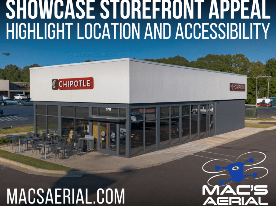
Give Buyers the Complete Picture
With nearly every home search beginning online, your listing photos have just seconds to capture a buyer’s attention. While professional interior and exterior photography remains essential, drone photography for home listings has become one of the most effective ways to showcase a property’s full value when used in the right situations.
According to research from Zillow, aerial photography has become an integral part of modern real estate marketing because it provides buyers with perspectives that traditional photography simply cannot capture. Zillow recommends drone photography for properties where location, land, views, or surrounding features are major selling points.
However, drone photography isn’t automatically the right choice for every listing. Understanding when aerial images add meaningful value can help homeowners and real estate agents make smarter marketing decisions and maximize their return on investment.
Why Professional Photography Matters Before Buyers Ever Visit
Today’s buyers form opinions long before they schedule a showing. High-quality photography is often the deciding factor in whether someone clicks on a listing or scrolls past it.
A 2024 HomeJab industry report found that 74% of real estate agents hire a professional real estate photographer for every listing, recognizing that professional visuals have become an expectation rather than a luxury. The report also notes that aerial photography and drone video create excitement and help listings stand out in crowded online marketplaces.
Drone photography builds on that advantage by showing buyers something they cannot experience from street level.
Homes That Benefit Most from Drone Photography
Some properties naturally have features that deserve to be viewed from above. In these situations, aerial photography becomes far more than an attractive image—it helps tell the complete story of the property.
Large Lots and Acreage
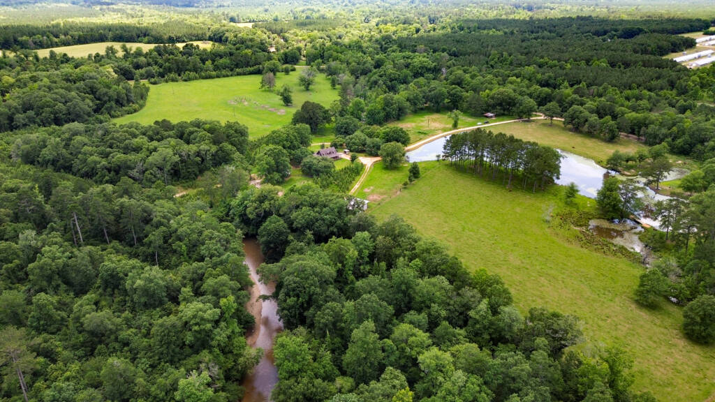
One of the biggest challenges when marketing acreage is helping buyers understand just how much land is included.
- Property boundaries
- Wooded sections
- Open pasture
- Driveways
- Barns and workshops
- Multiple buildings
- Buildable areas
- Overall property layout
For rural properties throughout Mississippi, Alabama, and Louisiana, these details are often major selling points that cannot be appreciated from ground level alone.
Waterfront Properties
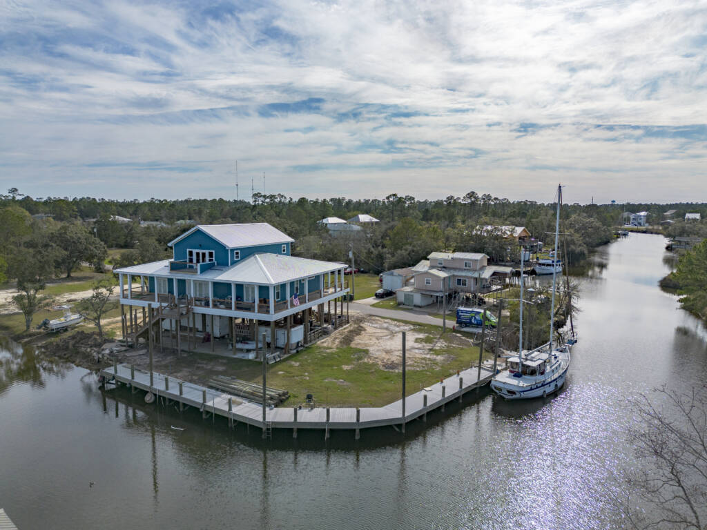
Waterfront homes almost always benefit from aerial photography.
Drone images can reveal:
- Water access
- Shoreline length
- Private docks
- Nearby marinas
- Views across the water
- Distance from neighboring homes
Even if a property sits a few blocks away from a lake, river, or the Gulf Coast, aerial photography can often demonstrate how conveniently located it is relative to those attractions.
Golf Course Communities
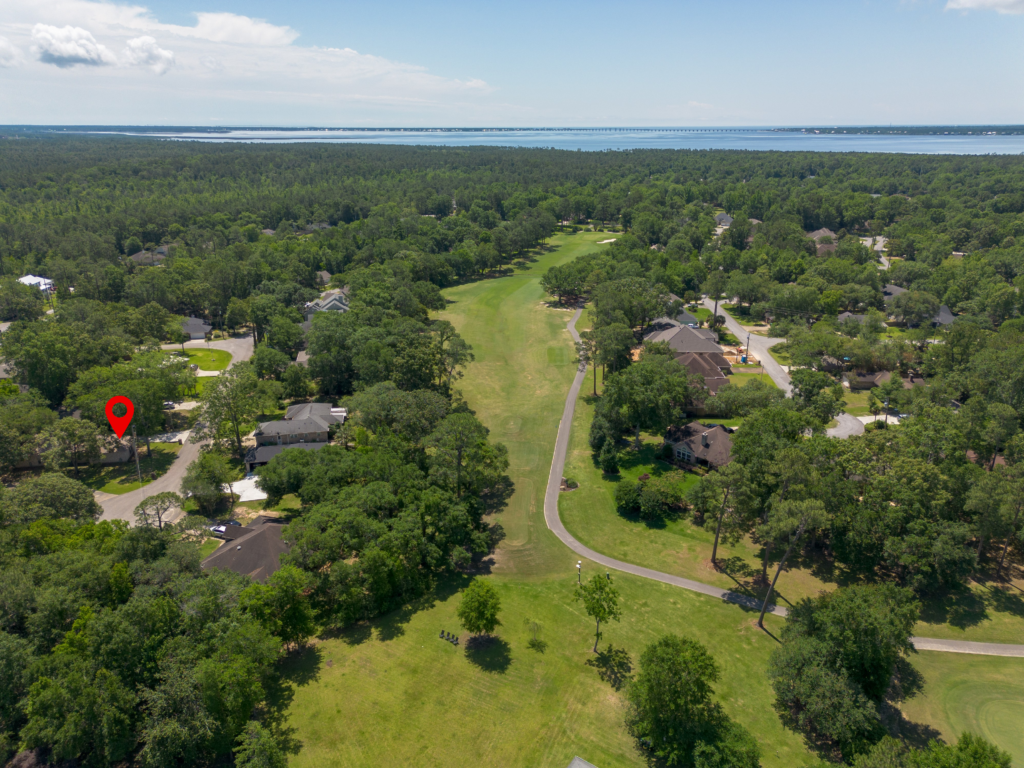
Homes bordering golf courses have value that isn’t always obvious from traditional listing photos.
Aerial imagery clearly illustrates:
- Fairway frontage
- Course views
- Walking distance to the clubhouse
- Green space surrounding the home
- Privacy compared to neighboring lots
For buyers specifically searching golf communities, these images immediately provide valuable context.
Luxury and Custom Homes
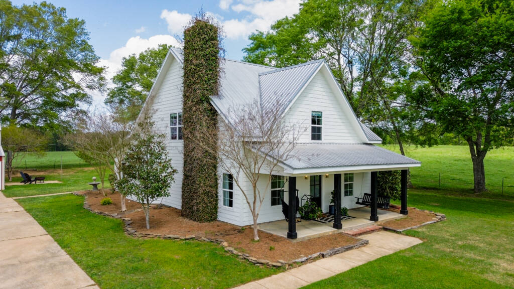
Luxury homes are designed to impress from every angle.
Drone photography highlights:
- Grand entrances
- Circular driveways
- Pools
- Outdoor kitchens
- Guest houses
- Landscaping
- Architectural symmetry
- Estate layout
Instead of focusing on isolated features, aerial photography allows buyers to appreciate the property as an entire estate.
Homes with Outstanding Outdoor Living
Sometimes the backyard is just as important as the house itself.
Drone photography showcases features like:
- Swimming pools
- Covered patios
- Outdoor fireplaces
- Horse facilities
- Detached garages
- Gardens
- Mature trees
- Large fenced yards
These amenities often represent significant investments that deserve to be presented from their best perspective.
Every Property Benefits From a Wider Perspective
Aerial photography doesn’t need acreage, waterfront, or a dramatic view to be useful.
Every property has context that can’t be fully captured from ground level. What changes from one listing to another is what that aerial perspective helps communicate.
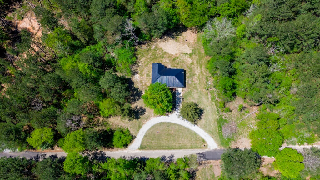
For a large rural property, aerial photography may be used to show the full extent of the land, wooded areas, open spaces, access points, and the distance between neighboring properties.
For a home on a smaller residential lot, the value may come from showing the entire property in a single image, the home’s position on the lot, driveway and access, roof, backyard, surrounding homes, and the overall character of the neighborhood.
Aerial photography can help provide context for:
- The entire property — See the home, lot, yard, driveway, and other features together rather than across several separate photographs.
- Access and layout — Show how the driveway, roads, structures, and different areas of the property connect.
- Privacy and seclusion — Give buyers a better understanding of wooded surroundings, open space, and distance from neighboring properties.
- The roof and exterior — Provide elevated views of areas that are difficult or impossible to photograph properly from ground level.
- The surrounding neighborhood — Show nearby homes, streets, development, and the general setting around the property.
- Nearby features — Establish the property’s relationship to waterfront, golf courses, parks, commercial areas, and other points of interest.
- Scale and perspective — Help buyers understand the property in a way that individual ground-level photographs cannot.
More Context Than Ground or Satellite Imagery Alone
Online maps and satellite imagery can certainly help someone understand where a property is located, but they aren’t a substitute for current, professionally captured aerial photography.
Satellite imagery may be older, captured during a different season, lack useful viewing angles, or simply not present the property at a quality suitable for professional real estate marketing.
Ground photography has the opposite limitation. It can provide beautiful detail but cannot always show how those individual details relate to one another.
Professional aerial photography fills the space between the two.
It provides current, high-quality imagery captured specifically to showcase the property while offering perspectives that aren’t possible with a camera standing at ground level.
That’s why we don’t view drone photography as something reserved only for luxury homes, waterfront properties, or large acreage.
The question isn’t whether there’s something worth showing from the air. It’s determining what aerial perspective tells the property’s story best.
Give Buyers the Complete Picture
Every listing has something that benefits from a different perspective. Mac’s Aerial approaches each property individually, choosing aerial views based on the home, land, surroundings, and features that buyers should be able to see.
From a residential lot in town to secluded acreage on the Gulf Coast, the goal is the same:
Give buyers a clearer, more complete understanding of the property before they ever arrive.