


Drone Services in Jackson, MS
Mac’s Aerial provides professional drone photography and videography for real estate, commercial properties, land, construction projects, and businesses throughout the Jackson metro area. We serve Jackson and surrounding communities with flexible project options and straightforward travel pricing.
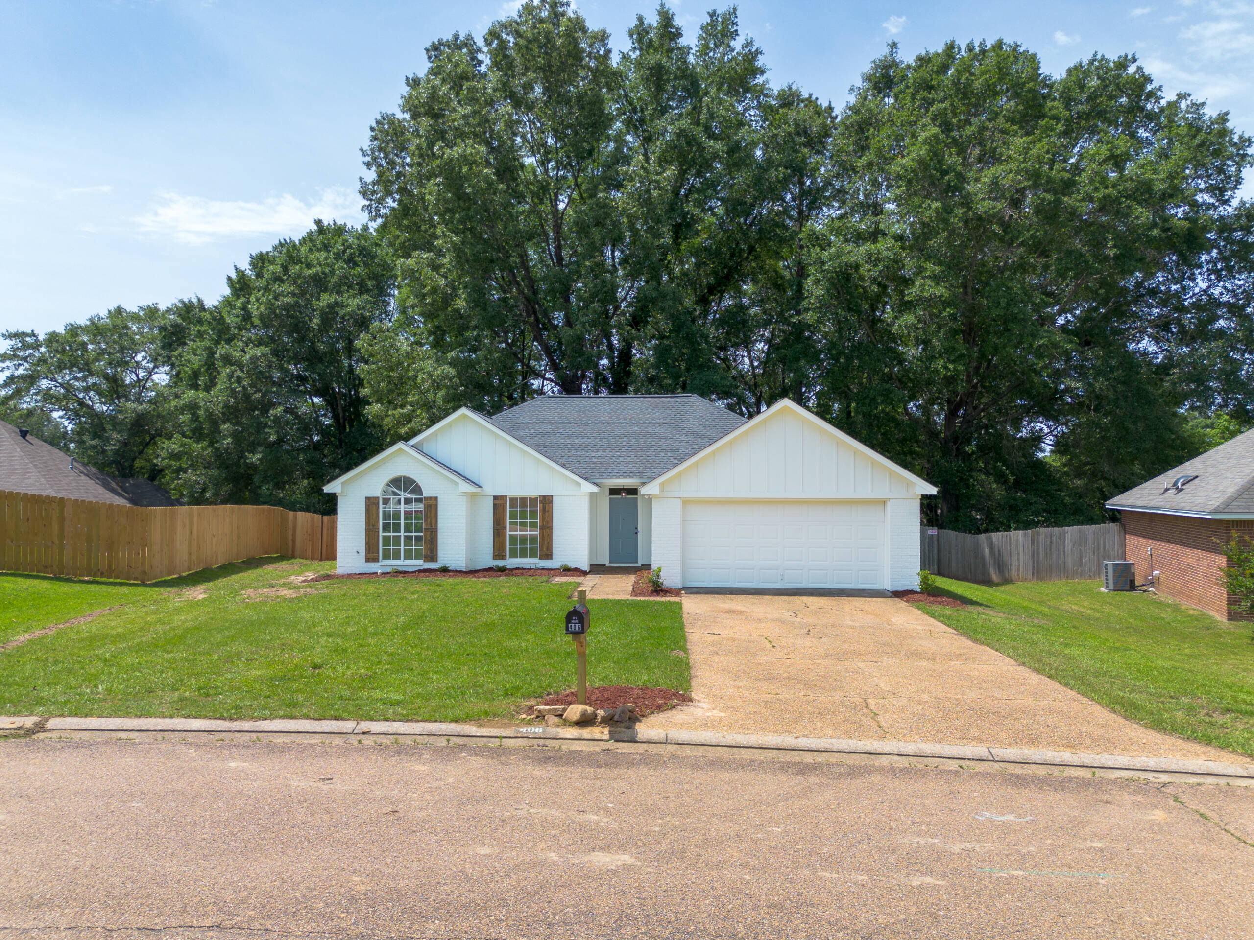
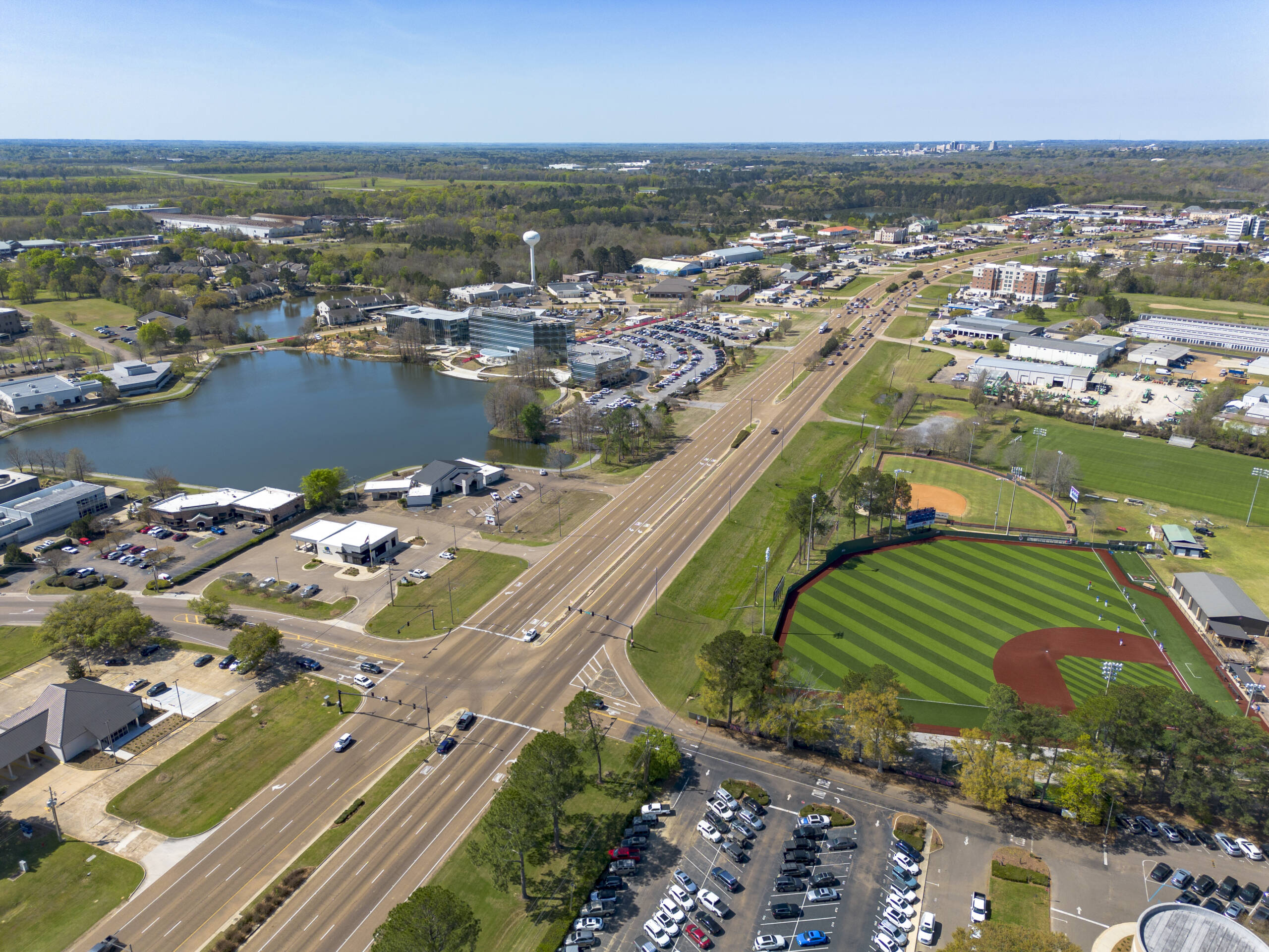
Imagery Built Around the Property
From commercial properties and real estate listings to acreage and construction sites, professional aerial imagery gives viewers a clearer understanding of a property’s layout, scale, surroundings, and key features. Mac’s Aerial combines drone and ground-level media to create useful, polished visuals tailored to each project.
Projects can include aerial photography, ground photography, drone video, property boundary overlays, nearby feature coverage, construction progress documentation, and custom editing. Whether the final media is being used for marketing, planning, documentation, or presentation, the goal is to make the property easy to understand and ready to showcase.
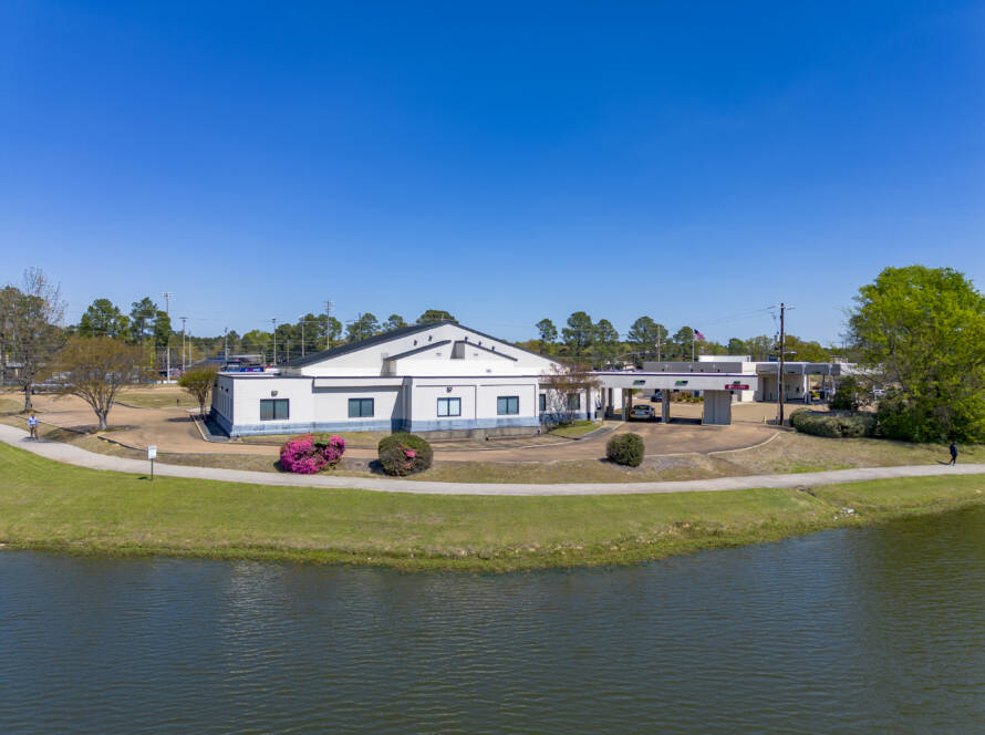
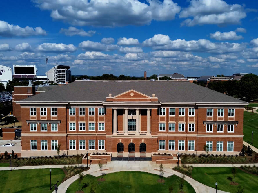
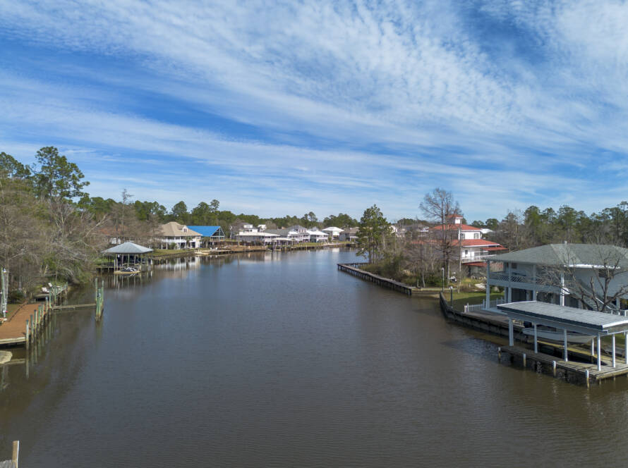
Ready for Projects
Across the Jackson Area
Mac’s Aerial serves projects throughout the Jackson metro area, including Jackson, Flowood, Brandon, Pearl, Richland, Ridgeland, Madison, Clinton, and surrounding communities.
Whether the project involves a residential listing, commercial property, construction site, acreage, or marketing campaign, each flight is planned around the location, property, and final use of the media.
Our existing Jackson-area work includes commercial property photography in Flowood, commercial land photography and video in Brandon, and residential real estate photography in Richland.
All drone operations are handled by an FAA-certified remote pilot, with airspace, weather, site conditions, and safety reviewed before each flight. The goal is simple: reliable service, professional results, and media that clearly shows the property or project from the right perspective.
Travel Fees by Location
Mac’s Aerial serves projects throughout Mississippi, Alabama, Louisiana, and surrounding areas. Depending on the project location, a travel fee may apply.
Want to check yours? Enter the project state and county in our Instant Estimate form to quickly see the travel fee for that location before submitting your request.
FAA Certified Flights

Every Mac’s Aerial project is performed in accordance with FAA Part 107 regulations, ensuring every flight is conducted legally, safely, and professionally. From pre-flight planning to airspace authorization and on-site operations, compliance is built into every step of our process.
Whether we’re photographing a residential property, documenting construction progress, or capturing commercial marketing content, you can trust that your project is handled by an FAA-certified remote pilot who follows current aviation regulations and industry best practices.
We believe great aerial imagery starts with responsible operations. That’s why every flight prioritizes safety, professionalism, and protecting your property while delivering exceptional results.
Why Clients Choose Mac's Aerial
Recent Work Around the Jackson Metro
Citizens Bank Commercial Photography Flowood, Mississippi
Commercial Land Marketing in Brandon, Mississippi
Neighborhood Home Real Estate Photography in Florence, Mississippi
Remodeled Home Real Estate Photography in Richland, Mississippi
Crossgates Plaza Aerial Photography
Have any questions? Find answers here
Find quick answers about our services, scheduling, travel, weather, FAA requirements, delivery, and what to expect from your project.
Still Have Questions?
Have a question about your project, location, or the services you need? Reach out and we’ll be happy to help.
Do you charge a travel fee for drone services near Jackson, MS?
Projects anywhere in Hinds County or Rankin County have no travel fee. Travel fees apply in Madison County and other locations. Enter the project’s state and county in our Instant Estimate form to see the exact fee upfront.
What areas around Jackson, MS do you serve?
Mac’s Aerial serves the Jackson metro, including Jackson, Clinton, Flowood, Brandon, Pearl, Richland, Ridgeland, Madison, and nearby communities. We also travel throughout Mississippi, Alabama, and Louisiana for drone photography and video projects.
What types of projects do you handle in the Jackson metro?
We provide aerial and ground photography and video for residential real estate, commercial properties, land and acreage, construction, roofs, retail locations, offices, and other property-related projects throughout the Jackson metro.
Depending on the project, coverage can also include interiors, property boundaries, nearby features, labels, and other enhancements.
How many photos should I order, and can I choose my favorites?
The right number depends on the size of the property and how much coverage you need. Smaller properties may only need a few images, while acreage and larger commercial properties often benefit from more.
Many projects include a review gallery where you can select your final images, and additional edited photos can be purchased if needed.
Can you fly at every property in the Jackson area?
Not every location has the same airspace requirements. We review the property location before flying and determine whether controlled airspace, airports, temporary restrictions, or other limitations require authorization or scheduling adjustments.
Can you handle multi-property projects around Jackson?
Yes. Mac’s Aerial can coordinate multiple properties and recurring projects throughout the Jackson metro for real estate professionals, property managers, developers, contractors, and other businesses. Grouping nearby locations can also improve scheduling and travel efficiency.
Do you offer video?
Yes. We offer both raw video clips and professionally edited video. Edited options can include music, text, property details, voiceover, and other enhancements depending on the project.
How does scheduling work?
Once the project details and required payment are completed, we’ll coordinate a date based on your timeline, location, availability, weather, and any applicable airspace requirements.
We’ll always try to accommodate your requested timeframe when possible.
What happens if the weather is bad?
Safe flying conditions and good visibility are important. Rain, storms, strong winds, or unfavorable cloud cover may require us to reschedule.
Clear or partly cloudy conditions generally produce the best results, and golden hour coverage is also available when a warmer or more dramatic look is preferred.
How does payment work?
Invoices are sent electronically through Square. Projects under $200 generally require full payment before scheduling, while projects of $200 or more generally require a 50% deposit.
Once the required payment is received, the project can be confirmed on the schedule.
Do you sign non-disclosure agreements (NDAs)?
Yes. If your project involves confidential property information, construction details, business operations, or other sensitive material, Mac’s Aerial can review and sign a reasonable non-disclosure agreement before the project begins.
How long does FAA authorization take?
It depends on the location and type of authorization required. Some eligible airspace requests can be approved through LAANC in near real time, while others require additional or manual FAA review.
Requests requiring further coordination should generally be planned at least 72 hours ahead, while the FAA recommends submitting manual DroneZone authorization requests at least 60 days before the proposed flight.
Because FAA approval timelines are outside our control, we recommend contacting us as early as possible for properties near airports or within restricted or controlled airspace. Authorization cannot be guaranteed.
When and how will I receive my photos?
Most photography projects are ready for review within approximately 1–2 days after the shoot, depending on the size and complexity of the project.
Final files are delivered digitally through a secure online delivery link.
Are the photos edited, and what file type will I receive?
Yes. Final photos are professionally processed for exposure, color, clarity, and overall presentation, with HDR processing used when appropriate.
Standard delivery includes edited JPG files suitable for listings, websites, advertising, presentations, and social media. TIFF or original DNG files can also be discussed when a project requires additional editing flexibility.
Do I need to be there, and how should I prepare the property?
Usually not. As long as we have permission to access the property and clear instructions about what needs to be captured, you generally do not need to be present.
When possible, we recommend moving vehicles, trash cans, equipment, temporary signs, and other unnecessary items before the shoot. For active commercial properties, scheduling during a less busy period can also provide cleaner exterior views.
Get an Estimate for Your Property
Browse our full range of drone photography and videography services to discover the best solution for your project.